CSAT Solved Papers/ 2025/Q65
2025 CSAT — Q65
There are places and in a city connected by various roads and . is km south of . is km west of . is km east of . is km north of . is km west of . is km north of . A person travels from to through these roads. What is the distance covered by the person?
Worked rationale
The seven places are joined only by the listed roads: . A trip from to must follow these edges, and the marks come from summing the known road lengths along a valid route.
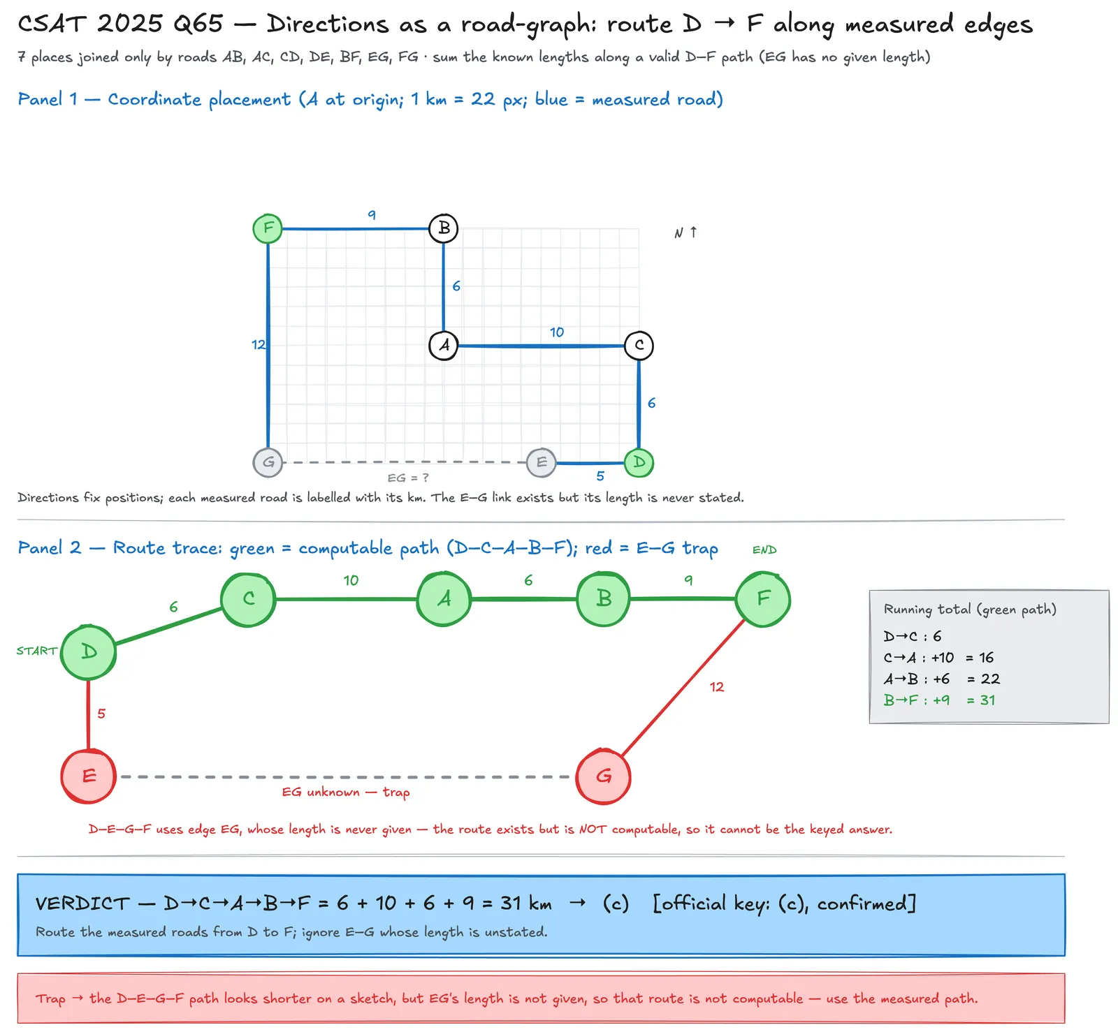
Roads with given lengths: (the length of is not given). Trace a path from to using only measured roads:
(The alternative uses , whose length is unspecified, so it is not the intended computable route.)
Answer: (c) 31 km.
Visual solution
The same solve, worked by hand — read it, then trace it.
Why the other options miss
- A missed a leg of the route: sums only part of the route (e.g. dropping a leg), short by the or segment.
- B an arithmetic slip: in adding (e.g. uses or drops a unit).
- D solved the wrong question: adds an extra road not on the – path (double-counts a leg or includes ).
Specialist insight
This is a graph-traversal item dressed as a directions puzzle: the directions only confirm the road lengths; the real task is to route along the given edges and add the lengths. The trap is the alternative — it looks shorter on a sketch, but has no stated length, so it cannot be the keyed route. Identify which roads carry numbers first, then find the -to- path that uses only those: . A quick coordinate sketch (place at origin) confirms the adjacencies without ambiguity.
Route along the measured roads: km (the – route is unusable — 's length isn't given).